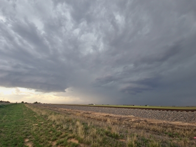
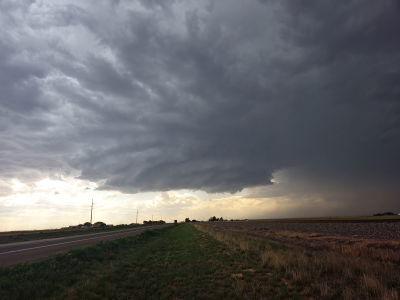
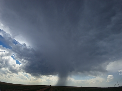
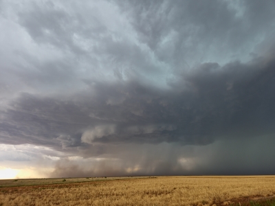
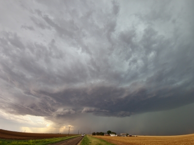
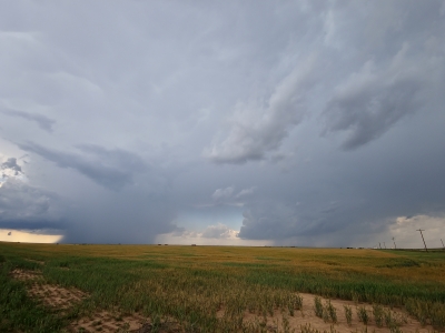
What a day this was.
Intercepted a nice supercell just north of Sydney, CO. When I arrived the storm was inflow dominate. A little while later it became outflow dominate. You could see the hail core getting larger as I was standing there. Reports of 3 inch hail were being reported. As the storm became outflow dominate winds picked up to 40mph plus. As the hail core was getting closer I moved south towards Sydney. Stopped in a few locations for pictures. I proceeded east in I-80. Again, stopping for pictures when able.
I got back to Julesburg and looking at radar I decided to head south. This was a mistake. I should have continued east on I-80. At this point the outflow was pushing out faster than the main storm. Some reports had winds in excess of 70 mph. As I headed south more storms were developing to the west and southwest. Once I got down to Wray, CO I headed east. I was starting to get hit with hail. I took cover under a gas stations roof an waited it our until the storm past.
Once the storm past I headed west back towards Wray. Once there I headed south for awhile then headed back to were I started the day in Goodland, KS.
I will post images later on. I did record some video of the outflow near Sydney.
As of right now my storm vacation is done. The next two days don't look promising. However, If some storms approach were I am of course I will see what I can get.
Start Time: 9:30am
End Time: 8:15PM
Mileage: 573
Another interesting day on tap. SPC has issued a 5% chance of tornadoes in southwest NE and northwest KS. With a 30% chance of significant hail and wind.
Currently the models are in agreement that storm initiation in the southern panhandle of NE.
Looking at heading towards North Platte, NE and reassess. More than likely will be heading west into CO.
Well had a good day of chasing. Caught a low precip cell north of Stratton, CO. It produced several mesocyclones that were photogenic.
Proceeded towards Holyoke, CO. Stopped just south and did some video and took pictures of lightning. Stayed there for awhile until several bolts struck nearby. These bolts originated in the anvil. Anvil lightning are positively charged, compared to what normal cloud to ground are negatively charged.
Stats for the day:
Start time: 9:30am
End Time: 9:15pm
Mileage: 642
Wit the recent update from the SPC, they are calling for a 2% chance of tornadoes from western NE and KS, and eastern CO. Also, a 15% chance of significant hail in northwest KS. Significant hail is larger than 2 inches. Plus, a 15% chance of significant wind in southwest KS.
Looking at the current CAMS(convective allowing models), not much agreement on timing and location.
However, there are several shortwaves moving through the mid-level flow that might create enough lift to get storms going. The dewpoints will be in low to mid 60's. There is enough CAPE of 2500 to 3000 joules per kilogram.
The dynamics are in place its just see if everything can come together.
Will be waiting to see the next SPC update in about 3 hours. Will be checking models again when I stop for lunch.
Left Amarillo and headed to Dalhart, TX. From there I headed west into NM watching storms develop off of the Raton Plateau.
I got to Des Moines, NM and headed north into CO. Still watching the storms develop off to my west. The storms then headed southeast. From where I was located there was no roads to get me into the OK panhandle. Those storms did go severe warned.
In CO I headed east into KS. As I got close to Garden City I could see a thunderstorm developing. Unfortunately, the closer I got to Garden City the storm started to dissipate.
Overall, got to see some scenic areas of northeast NM and southeast CO. Not much in the way of storms.
Stats for the day:
Start time: 11:00am
End Time: 6:45pm
Mileage: 425
The next few days look to be the central plains.
This morning will be heading up to Lamar CO. Once there will take a look at the models to see whats going on.
Currently, the SPC is calling for 2% chance of tornadoes and a 15% chance of hail and wind.
Looking at the current models. Today looks to more of a hail and wind event. The lack of a low level jet and 0-6km bulk shear is almost non existent.
Will be looking for maybe some nice structure and lightning today.
Left late morning from Amarillo and headed towards Lubbock. From there headed west towards Seminole, TX. At this point I checked models, radar, and what I was seeing for myself. I then headed north to Plains, TX watching a cell develop. However, as fast as it went up, it died.
Then went back looking at radar. A Tornado watch had been issued for the Midland and Odessa area. I proceeded south towards Midland.
This storm produced at least tornadoes and 3" hail. Heavy flooding in Midland, roads under water. I finally got on the storm just around 7pm.
Here are three images from the chase. I have another 110 to process when I get home.
Stats for the day:
Start time: 11:15am
End Time: 00:45am Friday
Mileage: 790
Currently there are two possible areas to chase. One is north of Amarillo and the other just south of Lubbock. Both have pros and cons.
The one down by Lubbock is call for baseball sized hail and a possibility of tornadoes. North of Amarillo the models show a similar but lesser chance of tornadoes. The other problem for Amarillo is how does the outflow from this morning storms interact with the incoming trough.
At this time either one is less than a two hour drive.
Will have to wait a few more hours to see how the models handle the on going convection.
All I can say it was largest and the longest lived storm I have ever been on.
Texas Tech Doppler on Wheels measured a wind gust of over 94mph.
One tornado was reported and was on the ground for less than a minute. However, we did not see it. If we wanted to we would have to punch the core and the chances of coming out unscathed was pretty much nonexistent.
The storm gave us a very nice light show from start to finish. At one point it was putting out over 100 flashes a minute.
Our chase started near Tucumcari, NM at around 4pm and finished near Clovis, NM some five hours later.
I will post images later as we will be heading back to Denver soon. With a chance of seeing some more storms on the way back north.
Another interesting day to chase. Pretty much the same for hazards, 2% chance of tornadoes, and 15% chance of winds and hail.
Looks like we might be heading towards the northwest part of the Texas Panhandle.
The next Storm prediction Center update should be interesting to read on how the rest of the day will go.
A good chase day. Saw several good storms. One had hail the size of softballs, one car had its back window blown out from it.
Lightning everywhere you looked.
Here a few images from the day:
After staying in Amarillo for the last three days we will be heading south.
Weather wise for today just about the same setup as yesterday, but just further south and east. Chances for tornadoes 2%, 15% chance of winds and 15% chance of significant hail.
With more upper level shear we should have better structure and more photogenic supercells.
Weather for the next few days is marginal at best, but at least we should see some storms.
Some images from yesterday. We were between Amarillo and Lubbock.
Started on the storms around 2pm and finished around 8pm. Did see one funnel cloud, but it never reached the ground so no tornadoes yet. Saw some pea size hail.
Day 9 update:
Saw some storms none on them severe. I did get one image of lightning, but its far off in the distance.
So no images from yesterday to post.
Today we will again be in the Texas panhandle. The Storm Prediction Center has a slight chance of severe weather for today. Right the forecast is calling for 15% chance of wind and hail, and 2% chance of tornadoes. Our most likely play for today will be from Wheeler, TX down to Childress, TX.
Still have some good storms to chase on Tuesday and Wednesday. After that its to far out to tell what will happen.
Today looks like the calm before the storm. Not really calm as we will heading out late morning to catch some thunderstorms as they initiate off the cap rock. The goal today is to get some good lightning shots.
Tomorrow Day 10 looks like a 5% chance of wind and hail, and a 2% chance of tornadoes. This covers most of the TX and OK panhandles.
Then on Tuesday we are looking at almost the same setup but more towards the Childress, TX area. Again with all hazards possible.
Beyond that, looks like we will head back into CO for some storms, but that could change.
